 Open Source
Interactive Terminal World Map Terrascope in Python
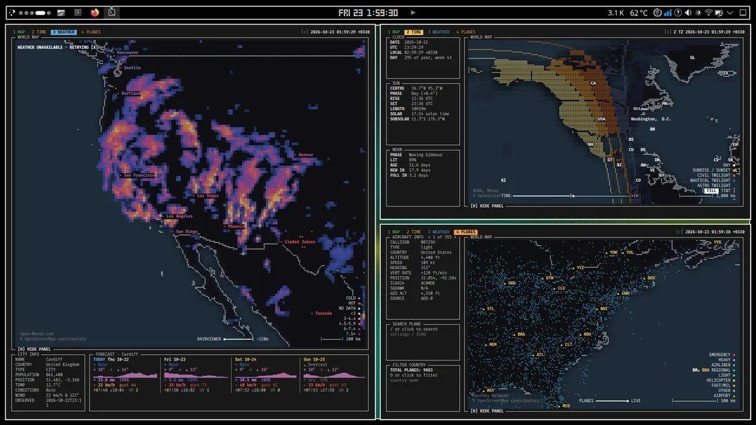
Terrascope is an interactive world map for the terminal that visualizes global data using Unicode Braille symbols and a console color palette. The project is written in Python and allows tracking aircraft movements in real time.
The tool displays current weather conditions in cities, radar data, day/night boundaries, and earthquake information.
- Real-time flight tracking
- Weather data for various cities
- Earthquake and radar visualization
- Day and night boundaries
The program provides a convenient way to monitor geographical and meteorological processes directly from the command line, using text characters to create a detailed map.
1.6K views